Rapid Transit system map
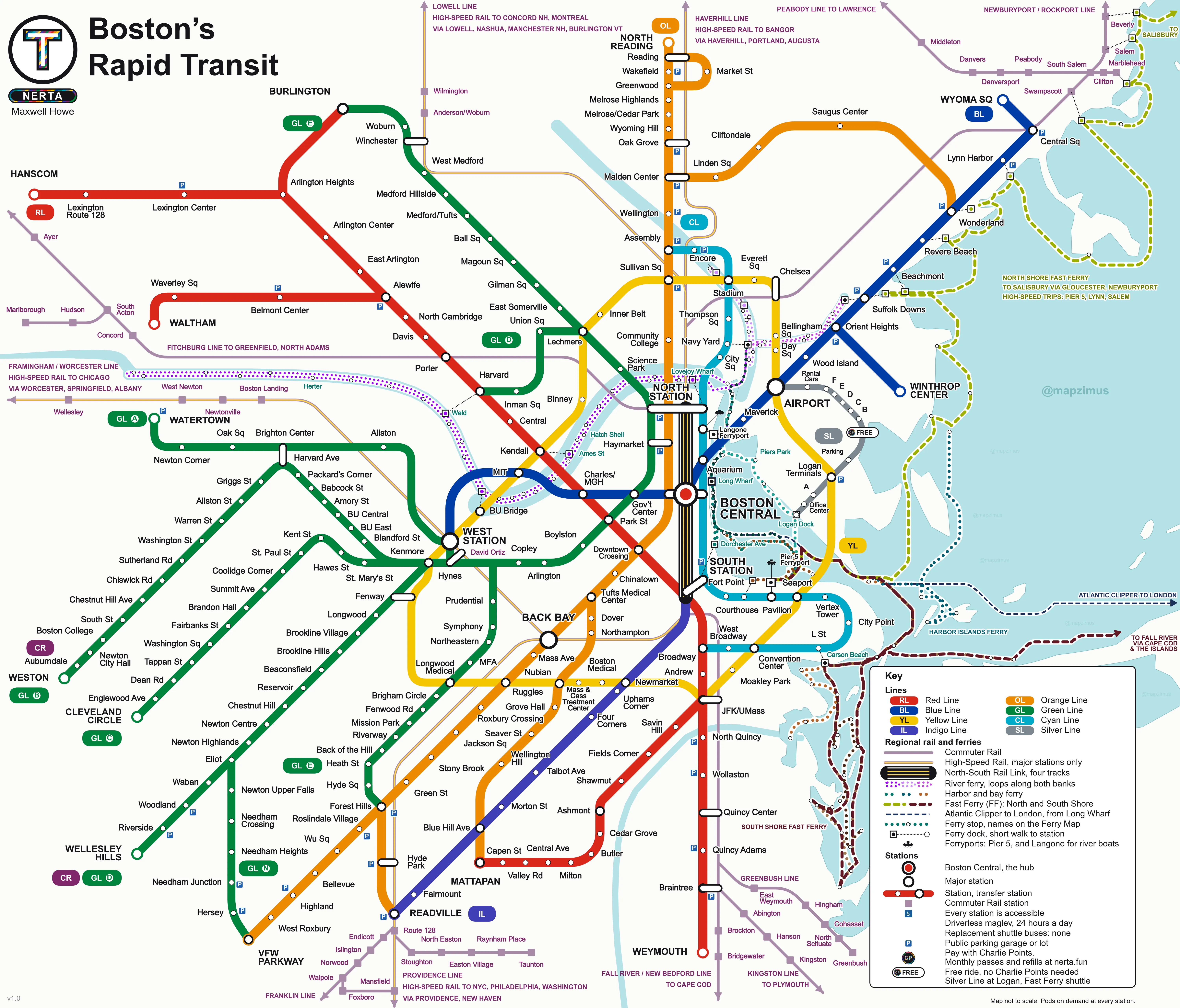
System mapEvery station, Regional Rail, High-Speed Rail and ferries.
Ways to use it
- Interactive map: tap any station for departures.
Reading the map
- A ring on a station means you can change lines without leaving the platform area.
- White capsules join stations a short walk apart.
- Thin purple lines are Regional Rail. Gold inside purple is High-Speed Rail.
- Dotted colored lines are ferry routes.
Street map
Street map: every stop at its real location
Subway, Regional Rail, High-Speed Rail and ferries drawn on real streets and track. Pick a line, find a stop, tap for departures.
Ferry, Regional Rail and Trams
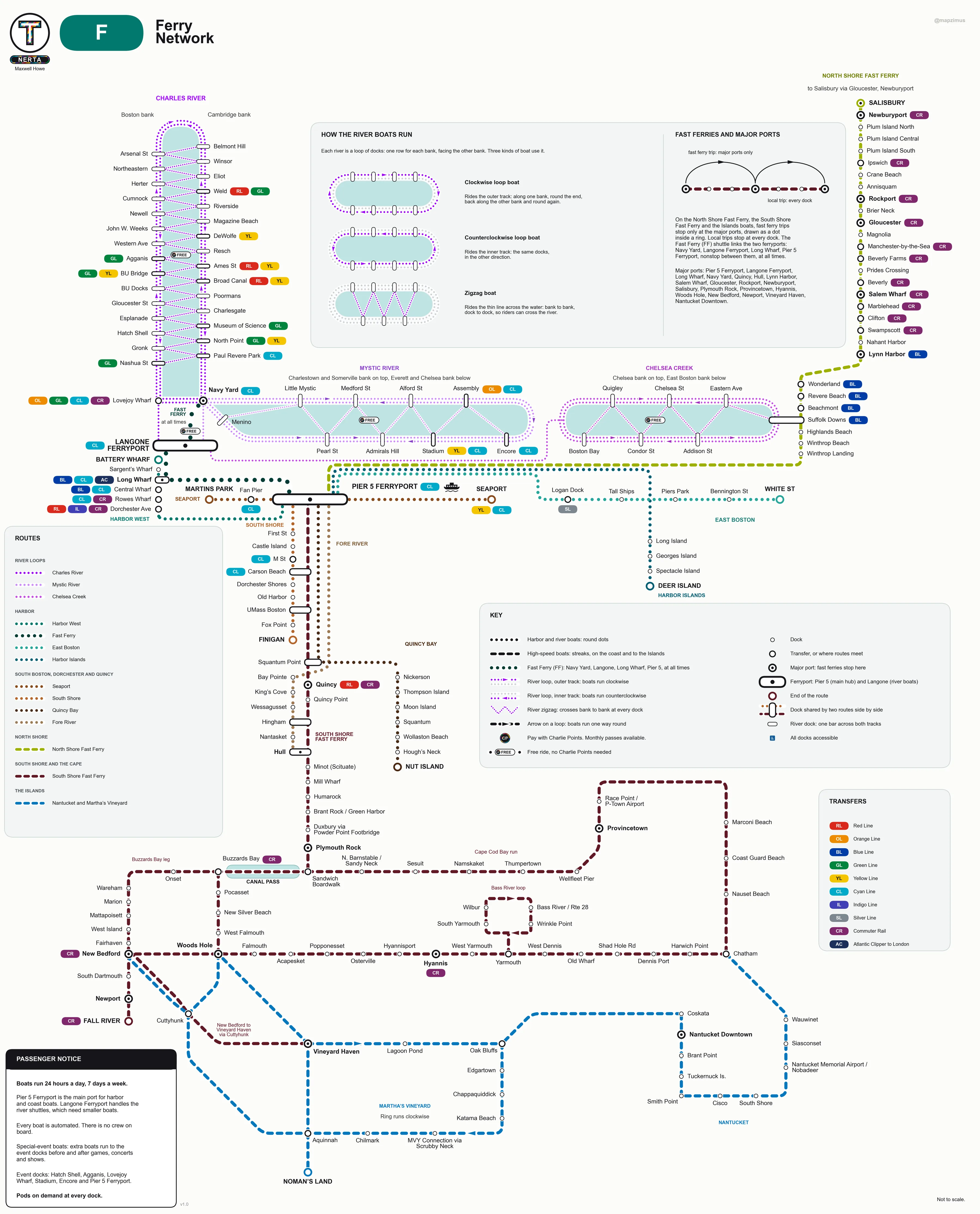
F Ferry networkEvery route and dock, from the rivers to the Islands.
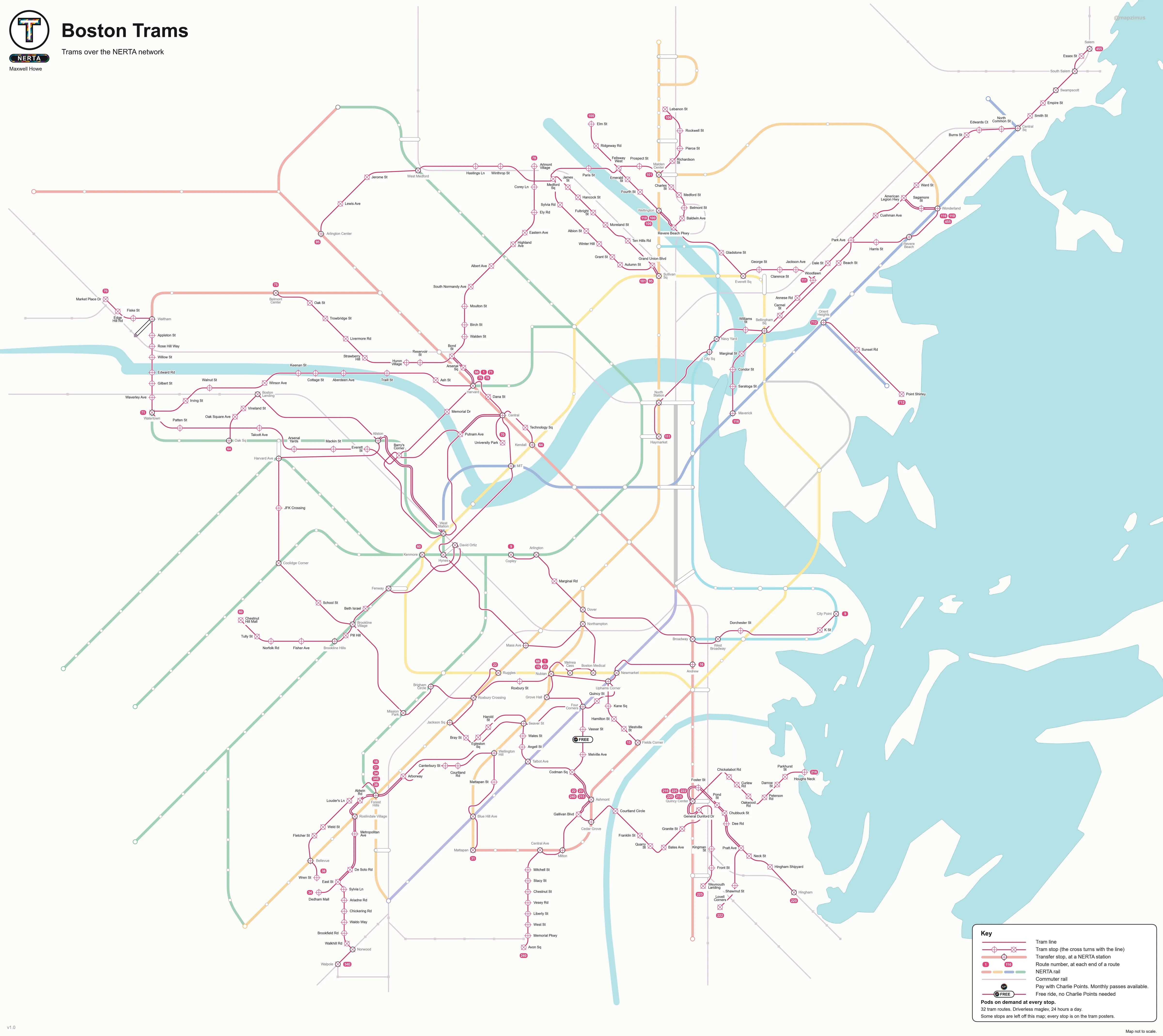
T Tram mapEvery route and stop, on one map.
RR Regional Rail
All eleven lines and High-Speed Rail, with every station and timetables.
Line maps
Every station on the line, with each transfer marked beside it.